Natural Disasters in Washington State: Two Seasons, Two Sides of the Cascades
The west side floods from November to March. The east side burns in July and August. Mount St. Helens and the 2001 earthquake are the reminders that the ground moves too. Here is the record, and the kit that fits it.
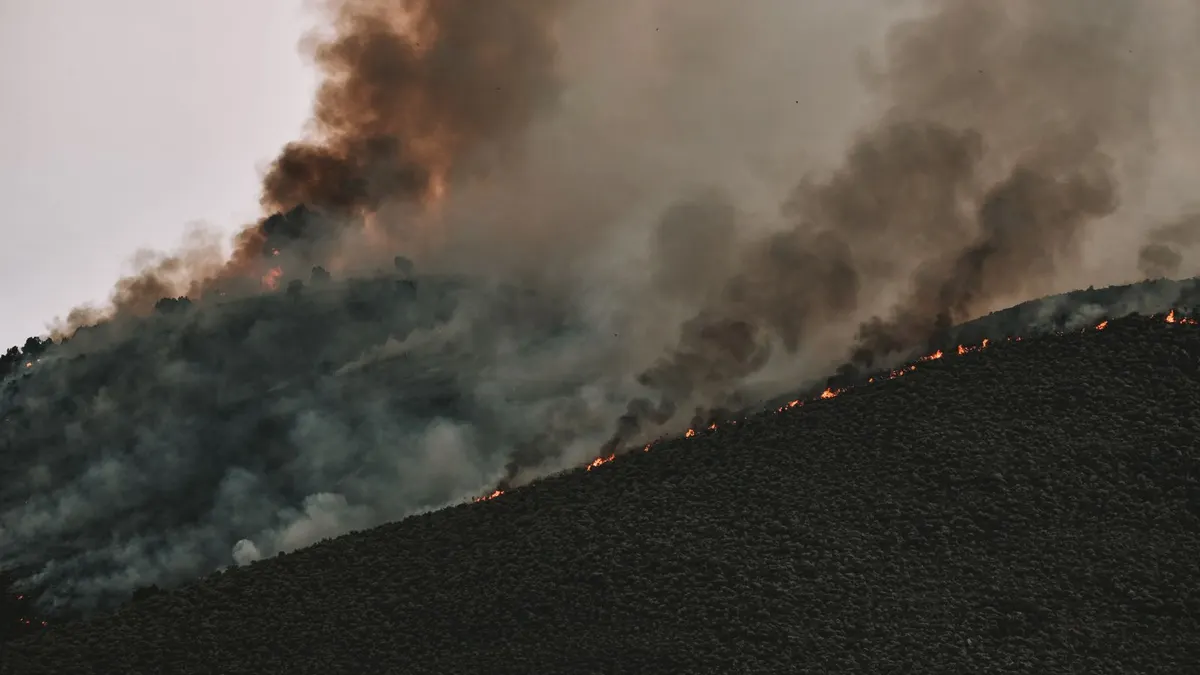
Washington is really two states when it comes to natural disasters, and the FEMA record of natural disasters in Washington shows the seam. West of the Cascades, the problem is water: three quarters of the state's major disaster declarations are floods or winter storms that brought wind, landslides and mud, and nearly all of them began between November and March. East of the mountains, the problem is fire: more than two thirds of the state's 223 declarations are fire related, and most of those began in July or August. Then there are the things that ignore the calendar. The May 1980 eruption of Mount St. Helens was the widest declaration for a natural event in the state's history until the December 2025 storms beat it this past April. And the February 2001 earthquake put 24 counties under a declaration with no warning at all.
So the first question for anyone reading about natural disasters in Washington is which side of the Cascades you sleep on. The west side kit is built for a week of rain, wind and no power: a weather radio, lanterns, stored water for the boil notice, and a get home bag in the car for the day the highway closes under a slide. The east side kit is a wildfire go bag packed by the Fourth of July, with masks for the smoke. Everybody gets the earthquake layer, which is mostly water. This page is part of the natural disasters by state series, and the base list behind all of it is the power outage kit checklist.
One thing to know before the numbers. A major disaster declaration is the full federal response. An emergency declaration is smaller and faster, signed while something is still happening, which is how Spirit Lake got one in 1982 for the threat of a flood two years after the eruption dammed it. A fire management declaration is a cost-share for fighting one named fire, and every fire is its own record. FEMA has only filed those in volume since about 2001, so nearly all of Washington's stack up in the last 25 years, and that's why the 2010s and 2020s look like the sky is falling next to the 1970s. Some of that is more fire. A lot of it is more paperwork. The 2005 Katrina evacuation and COVID in 2020 went to every state and aren't weather; the tables below leave them out.
Washington disasters by type, 1956 to 2026
| Hazard | Major declarations | When it usually hits | Example from the record |
|---|---|---|---|
| Flooding | 32 | December and January, again in March | December 2025 storms, declared April 2026, 49 designated areas (FEMA counts tribal areas alongside the 39 counties) |
| Winter storms with wind, landslides and mud (filed as severe storm) | 20 | November through January | Winter storms of December 1996, 38 counties |
| Wildfire | 8 major, plus 144 fire management | July and August | September 2020 wildfires and straight-line winds, 12 counties |
| Earthquake | 2 | Any month | February 2001, 24 counties |
| Landslide | 2 | March | March 2014 landslide, 4 counties |
| Volcanic eruption | 1 | Once | Mount St. Helens, May 1980, 39 counties |
| Ice storm and fishing losses | 2 | Scattered | November 1996 ice storm, 3 counties |
Counted by major disaster declarations: 68 in all, with 11 emergencies and 144 fire management declarations on top. Katrina evacuation and COVID left out.
Which counties get hit the most
| County | Declarations since 1956 | Side | Main hazards |
|---|---|---|---|
| Chelan (Wenatchee) | 53 | East | Wildfire, spring flooding |
| Okanogan | 42 | East | Wildfire |
| Yakima | 39 | East | Wildfire, ash in 1980 |
| Snohomish (Everett) | 37 | West | Floods, windstorms, the 2014 landslide |
| Lewis (Chehalis) | 37 | West | River flooding, Mount St. Helens |
| King (Seattle) | 35 | West | Floods, windstorms, the 2001 quake |
| Grays Harbor | 35 | West | Coastal storms and flooding |
| Wahkiakum, Spokane | 33 each | West, East | Lower Columbia flooding; wildfire and snow |
| Mason | 32 | West | Floods and windstorms |
| Thurston (Olympia), Jefferson | 30 each | West | Floods, the 2001 quake, coastal storms |
All 39 counties have been named in at least one declaration. The top of the list is split almost evenly between the dry side and the wet side, which sums the page up in one table. Lewis County sits where the Chehalis and the Cowlitz run, and it shows.
West side: the flood and windstorm season
Put floods and the winter storms together and you have 52 of Washington's 68 major disasters. The start months tell you when to worry: December and January lead, March has a second flood peak when snowmelt meets rain, and from April through October the two categories together have produced only ten declarations in seventy years. Fall rain on a snowpack, a windstorm on top of it, and the rivers that drain the Olympics and the west slope of the Cascades come up overnight.
| Event | Counties on the major declaration | Note |
|---|---|---|
| Storms of December 2025 | 49 | Declared April 2026; the widest weather declaration Washington has ever had |
| Winter storms, December 1996 | 38 | Landslides and flooding |
| Winter storm, December 2008 | 34 | Record snow, with a 23-county flood declaration right behind it |
| Flood, January 1996 | 24 | |
| Storms of late 2021 | 24 | Declared March 2022 |
| Flood, December 1964 | 21 |
Below those sits a run of ten- to nineteen-county declarations in a dozen different years from 1974 to 2024. This isn't a once-a-decade event. Washington has had a flood or winter storm major declaration in 19 of the last 30 years.
What the west side kit needs: a NOAA weather radio with the alert on, because flood and landslide warnings come at night. Lanterns and headlamps and a solar power bank, since a windstorm on the Sound takes the grid down for days and the rain doesn't stop while you wait. A week of stored water for the boil notice that follows a flooded well field. And a get home bag in every car, because the I-5 corridor and the mountain passes close under slides, usually with no notice.
East side: fire in July and August
The fire months are as sharp as the flood months. July and August between them hold more than three quarters of the fire declarations, September most of the rest, and nothing at all from November through April. The heavy years in the fire management file are 2015 and 2020, with 2018 and 2026 close behind. The fires that got into towns earned major declarations: the October 1991 fires, the July 2014 fires, the August 2015 fires (a 15-county emergency, then a major declaration for wildfires and mudslides that October), the September 2020 fires with straight-line winds across 12 counties, the August 2023 fires with individual assistance, two single-county fires in the summer of 2024, and the August 2026 fires that drew a 9-county emergency declaration.
The county list tells you where. Chelan County leads the whole state, more than any county on either side of the mountains, with Okanogan, Yakima and Spokane behind it. The 2026 fire management records name the Yakama Reservation, the Colville Reservation, Okanogan, Spokane, Stevens and Ferry counties, which is the same ground that burned in 2014, 2015 and 2020.
The east side kit is a go bag per person, packed before July and kept where you can grab it in the dark: documents, medications, N95 masks, phone chargers, a change of clothes, and whatever it takes to move the animals in one trip. The bug out bag checklist has the full list. Two things people in the Methow and the Okanogan learn the hard way: the smoke comes well ahead of the fire, so the masks matter even if you never evacuate, and the power goes out when the lines burn, so the grid-down kit isn't optional on the dry side either.
The ground moves: Mount St. Helens and two earthquakes
Washington's single volcanic eruption declaration is the one everybody knows. The major declaration for the Mount St. Helens eruption is dated May 1980 and covered 39 counties, which held the state record for reach for 46 years. Two years later Spirit Lake, dammed by the debris, got its own emergency declaration for the threat of flooding. Ash travels a long way downwind, so an N95 mask and a way to seal a room are the ash kit, and that goes for the east side as much as the mountain towns.
The two earthquake declarations are May 1965 and February 2001, the second one the widest earthquake declaration in the state's file. Only California has more in our series. Washington's are decades apart and come without a season, which is exactly why the earthquake kit has to exist before you need it. Water is most of it: a quake breaks mains and the tap is the first thing to go. Keep a week per person and read how to store water long term so it's still good in year three. Then shoes by the bed, a wrench on the gas meter, headlamps, and a way to reach family when the cell network is jammed, which is where a pair of GMRS radios or a Meshtastic node earns its place.
And the landslides. Washington has two major landslide declarations, March 1998 for a single county and the March 2014 slide, which drew an emergency declaration and then a 4-county major declaration with individual assistance. March is the slide month in this file, after the ground has been soaked all winter.
The Washington calendar
- November through January: flood and windstorm season on the west side, and half of all the state's flood and storm declarations. Weather radio on, water stored, car fueled.
- February and March: the second flood peak as snowmelt meets rain, and the landslide month. Both slide declarations began in March.
- April through June: the quiet stretch. Rotate the water, repack the bags, restock.
- July and August: more than half the state's entire file, all of it fire. Go bag by the door east of the Cascades, masks everywhere the smoke reaches.
- September and October: fire season winds down, the first fall storms arrive.
- Any month: earthquakes and the mountain. Two quakes and one eruption, decades apart, no pattern.
What to build, by side
- Everyone: water and the grid-down base. A week of stored water per person covers the quake, the boil notice after a flood and the post-fire outage. Add lanterns, a crank weather radio, phone power, shelf food, cash and documents from the power outage kit checklist.
- West side: the winter layer. Sandbags if you're near a river, a tarp and a chainsaw if you have trees, emergency blankets for a cold house with no power, and the get home bag in the car.
- East side: the fire layer. A packed go bag by July, N95 masks, the animal plan, and a written trigger for when you leave.
- Everyone: the earthquake layer. Shoes by the bed, a gas wrench, a flashlight you can reach in the dark, and the water you already stored.
- Communications. Cell service goes with the power on both sides. GMRS for the household, Meshtastic for the neighborhood.
Questions people in Washington ask
What is the most common natural disaster in Washington state?
By major disaster declarations, flooding, plus the winter storm declarations that usually involved flooding too; together they're three quarters of the major disasters since 1956. By raw count it's wildfire, but nearly all of those are single-fire management declarations that mostly cover rural ground east of the Cascades.
Is western or eastern Washington more dangerous?
Different, not more. The west side holds nearly every flood and winter storm declaration and both earthquakes. The east side holds nearly every fire. The top county in the whole file, Chelan, is on the east side, and the next three below it are split two and one. If you have to pick a worse season, it's July and August on the east side; December and January on the west side are a distant second.
How often does Washington get a flood declaration?
Often. A flood or winter storm major declaration has landed in 19 of the last 30 years, and the April 2026 declaration for the December 2025 storms covered more counties than any weather event in state history.
When is wildfire season in Washington?
July and August, by the start dates in FEMA's file, with September a distant third. The worst recent years were 2015, 2020, 2018 and 2026.
Has Washington had a federal disaster for an earthquake?
Twice: May 1965 and February 2001, the second one across 24 counties. That's the second most of any state in our series, behind only California.
Does a declaration mean FEMA will pay me?
Households get paid only when the declaration includes individual assistance for your county. In Washington's file that has been true for the October 2003 storms, the November 2006 and December 2007 storms, the January 2009 flood, the 2014 landslide, the November 2021 flood, the August 2023 and June 2024 fires, and the April 2026 flood declaration. Most of the others repaid counties and cities only. Look up the declaration on FEMA's site for your county. Photos of the property taken before the season are worth more than any taken after.
Putting it together
Store the water and build the grid-down kit, because the quake, the flood week and the fire outage all need the same things. Then add the winter layer on the west side or the go bag on the east side, and put a weather radio in every house regardless. The figures on this page are FEMA's public declaration file as of October 31, 2026, and I'll update them as new declarations post. Neighbors in the series: Idaho and California. The gear guides are in the storm prep section.
Sources
Ready to buy?
See current models and availability on Amazon. Your clicks keep these guides free.
Shop Emergency Kits on Amazon →