Natural Disasters in Virginia: Statewide Snow, Mountain Rivers, and the Tropical Rain That Fills Them
The widest declarations in the file are blizzards. The ones people remember are hurricanes that arrive as rain. What the record shows, when it comes, and what to have ready.
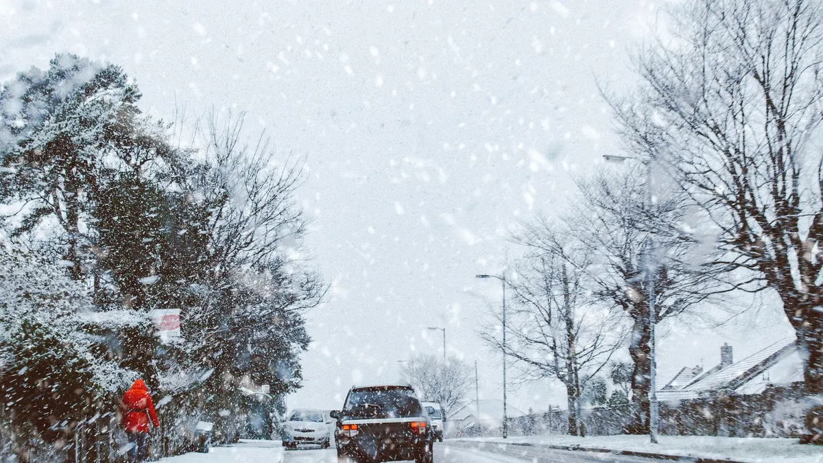
Snow, not hurricanes, produced the widest declarations in the FEMA record of natural disasters in Virginia. The March 1993 storm, the Blizzard of 1996 and the January 2026 winter storm each covered nearly every county and independent city in the state. Only Hurricane Sandy's emergency declaration in 2012 reached the same size, and Sandy's major declaration a month later covered a fraction of that. So the honest answer to "what natural disasters happen in Virginia" has two halves. Winter storms shut the whole state down at once. Tropical rain, from Agnes in 1972 through Isabel, Irene, Florence, Michael and Helene, does the lasting damage, and it does most of it in August, September and October.
Virginia has 77 declarations on record from 1957 through January 2026, 58 of them major disasters. Severe storms lead the major count, then floods, hurricanes and snowstorms, and Virginia has more snowstorm declarations than any state in this series except New York. The kit for that record is a cold-weather version of the power outage kit, with a flood plan added anywhere near a river that drains the Blue Ridge. This page is part of our natural disasters by state series.
A note on the counting. A major disaster declaration is a presidential finding that a state can't handle an event alone; it unlocks repair money for localities and, when added separately, individual assistance for households. An emergency declaration is smaller and often comes first; Virginia got one for Sandy and one for Florence before either storm arrived. A fire management declaration covers one named wildfire, and Virginia has only seven, so unlike the western states its total isn't inflated by fire. FEMA names counties and independent cities separately, which is why Virginia declarations can list 136 areas. Two of the widest aren't weather at all, the 2005 Katrina evacuation (the state sheltered Gulf coast evacuees) and COVID in 2020, and the September 11 attack on the Pentagon is in the file as well, for Arlington alone. Set those aside and what remains is weather, with one earthquake.
Virginia declarations by type, 1957 to 2026
| Disaster type | Major declarations | When it usually hits | Example from the record |
|---|---|---|---|
| Severe storms (including several winter storms FEMA filed here) | 20 | Year round, with a January and February cluster | June 2012 straight-line winds (the derecho), 69 areas |
| Flooding | 16 | October and November lead, but every month has one | Tropical Storm Agnes, June 1972, 106 areas |
| Hurricanes and tropical storms | 12 (11 hurricane, 1 tropical storm) | August through October, nothing outside those months | Hurricane Isabel, September 2003, 100 areas |
| Snowstorms, ice and freezes | 7 (5 snow, 1 ice, 1 freeze) | December through March | Blizzard of 96, 136 areas |
| Earthquake | 1 | August 2011 | 10 areas, with individual assistance |
| Wildfire | 0 major, 7 fire management | February and November | Three fire complexes in November 2001 |
Counted by FEMA's incident label. Five more winter events are filed under severe storms, so winter is really closer to a dozen major declarations. The other 19 entries are emergencies and fire management declarations.
Snow and ice: the declarations that cover the whole state
Virginia's winter record is the one most people underrate. A winter storm has earned a federal declaration here in twelve different years since 1977, and the biggest ones are the biggest weather events in the file, period.
| Winter storm | Areas covered | Note |
|---|---|---|
| March 1993 | 136 | Emergency declaration |
| Blizzard of January 1996 | 136 | The widest major declaration for weather in the state's history |
| January 2026 | 135 | Emergency declaration, nearly every county and city |
| January and February 2000 | 109 | Filed as severe storms |
| December 2009 and February 2010 | 50 and 38 | Back-to-back major declarations in one winter |
| February 2003 | 39 | Record snowfall plus rain and mudslides; individual assistance |
| February 2025, February 2021, January 2016, January 2022 | 28 to 36 each | The recent run |
The pattern for households is a multi-day outage in cold weather, with ice on the roads and tree limbs on the lines, and it reaches Richmond, Roanoke and Northern Virginia as readily as the mountains. The kit: a safe indoor heat source and a carbon monoxide alarm, emergency blankets and cold-rated sleeping bags, a lantern and headlamps, water stored before the pipes are at risk, and the winter car kit in every vehicle from December through March.
Tropical rain: Agnes to Helene
Hurricanes rarely reach Virginia with their wind intact. What reaches Virginia is their rain, and the rain falls on steep ground. Tropical Storm Agnes in June 1972 is the flood that set the standard, the widest flood event in the file by far. Nearly every tropical declaration since began in August, September or October; the one exception is the remnants of Ida in November 2009, filed as a severe storm.
| Storm | Year | Areas on the major declaration |
|---|---|---|
| Agnes (tropical storm, filed as flooding) | 1972 | 106 |
| Isabel | 2003 | 100, with individual assistance; the widest hurricane declaration in the file |
| Fran | 1996 | 88 |
| Irene | 2011 | 48 |
| Floyd | 1999 | 42 |
| Helene | 2024 | 37, with individual assistance |
| Michael and Florence | 2018 | 36 and 32, a month apart |
| Sandy | 2012 | 29 (136 on the emergency), with individual assistance |
Gaston and the remnants of Jeanne in 2004, Ernesto in 2006, Lee's remnants in 2011 and Matthew in 2016 round out the list with smaller declarations. The August 1969 storm, an early entry, is part of why Nelson County in the Blue Ridge foothills tops the state's county list today.
For households, the Virginia hurricane problem is a river problem. If you live along the James, the Rappahannock, the Shenandoah, the Roanoke, the Dan or the Clinch, the weather radio with the alert tone on is the piece of gear that matters, because a flash flood warning in the hollows is the one you can't afford to sleep through. Add waterproofed documents and a get home bag in the vehicle. On the coast and the Northern Neck, where Isabel and Sandy pushed water up the tidal rivers, the full seven-day kit applies; our hurricane kit checklist is written for the state next door and the list is the same.
Severe storms, derechos and tornadoes
Twenty major declarations carry the severe storm label, and once you set aside the winter events filed there, the rest are a mix of spring tornado outbreaks and summer wind. The June 2012 straight-line wind storm, the one people call the derecho, is the big one: 69 areas under a major declaration for a summer outage. The April 2002 tornadoes, the May 2004 storms, the June 2006 storms and the July 2001 flooding all drew smaller declarations. Severe storm declarations are spread across the calendar more evenly than any other type in the file.
The derecho is the event I'd plan around in Northern Virginia or the Valley, because a summer outage of several days in a house with no air conditioning is a different problem from a winter one. A solar power bank for phones, a battery fan, and the stored water cover most of it. Tornado prep is the weather radio, a safe spot, and a light source for after.
One earthquake, and the fires
In August 2011 an earthquake in central Virginia drew a major disaster declaration for 10 areas with individual assistance. Virginia is one of only six states in this series with an earthquake on its FEMA record, and, with New York, one of only two east of the Mississippi. There's no kit for it beyond the basics, but it's a reminder that the base kit should exist for reasons nobody can forecast.
Wildfire is a small line in Virginia: seven fire management declarations, all between 2001 and 2011, and all in February or November, the dry months with the leaves down. Three fire complexes burned in one week of November 2001, in the far southwest coal counties, the Shenandoah gap and the Blue Ridge above Charlottesville. The Fultz Run fire in Page County, the Bull Mountain fire in Patrick County, and two fires on one February day in 2011 in Rockingham and Warren counties make up the rest. If you live on a ridge in the Blue Ridge or the Alleghenies, a packed go bag in those two months is the whole plan.
The counties with the longest records
Counted as the number of separate declarations each county has been named in since 1957. The list is rural, and it traces the rivers that come off the Blue Ridge, the Northern Neck, Southside and the coal counties, not the cities.
| County | Declarations | Where it sits |
|---|---|---|
| Nelson, Bedford | 28 each | Blue Ridge foothills, the James and Roanoke headwaters |
| Pittsylvania, King George, Essex, Buchanan | 27 each | Southside, the Northern Neck, the coalfields |
| Greene, Craig, Appomattox | 26 each | Blue Ridge, Alleghenies, Southside |
| Westmoreland, Tazewell, Rappahannock | 25 each | Northern Neck, coalfields, Blue Ridge |
The pattern is steep ground and tidal rivers. The foothill counties flood when tropical rain stalls on the mountains, the Northern Neck takes the surge when a storm runs up the Chesapeake, and the coal counties flood from storms that stall over narrow valleys. A 2021 flooding and landslide declaration for a single county is the latest example.
A Virginia disaster calendar
- January and February: the heaviest non-tropical stretch in the file, nearly all snow and ice, plus the February fires. Winter kit, water stored, heat you can run indoors.
- March and April: late winter storms and the first spring tornadoes.
- May through July: the quiet stretch, but it holds Agnes and the 2012 derecho. Restock the kit, and keep the summer outage gear handy.
- August: tropical season opens: the 1969 storm, Bonnie, Dennis and Irene under the hurricane label, Gaston and Ernesto filed as severe storms, plus the 2011 earthquake.
- September: the worst month in the file: Fran, Floyd, Isabel, Jeanne, Lee, Florence, Helene.
- October and November: late tropical systems (Michael, Sandy, Matthew) and fall flooding, plus November fire season.
- December: one declaration in the whole record, the 2009 snowstorm. The month to check the generator and the blankets before January.
Build order for a Virginia kit
- The cold-weather base. Seven days of water at a gallon per person per day, shelf-stable food, a NOAA weather radio, headlamps, a way to charge phones, indoor heat with a CO alarm, blankets, cash and documents. The power outage kit checklist has the order. This is the kit for 1996, 2010 and 2026.
- The river layer. Anywhere the water comes off the Blue Ridge or runs to the Chesapeake: weather radio alert on at night in September and October, documents waterproofed, a get home bag in the truck, and a river level that means you leave.
- The coastal layer. Hampton Roads, the Northern Neck and the Eastern Shore need the portable seven-day hurricane kit and an inland plan for an Isabel-sized storm.
- The summer outage layer. Northern Virginia and the Valley: a battery fan, a solar power bank, and the stored water, for the next derecho.
- Communications. A pair of GMRS radios for the household and the street, because a wide outage can take the phones with it.
Questions people ask about Virginia disasters
What is the most common natural disaster in Virginia?
By FEMA's labels, severe storms and floods. Group the winter storms together, including the ones FEMA filed under severe storms, and winter weather is the single largest category with about a dozen major declarations, and the widest ones in the file.
Does Virginia get hurricanes?
Eleven major hurricane declarations and one for a tropical storm since 1957, plus six emergency declarations, every one of them beginning in August, September or October. Isabel in 2003 is the widest. The rest did their damage as rain and river flooding, Agnes in 1972 most of all.
What was the biggest disaster in Virginia by FEMA's count?
For a major disaster declaration, the Blizzard of 1996 at 136 areas. The March 1993 storm and Sandy's 2012 emergency declaration tie it, with the January 2026 winter storm one behind. Agnes in 1972 was the widest flood and Isabel in 2003 the widest hurricane.
Has Virginia had an earthquake disaster?
One. The August 2011 earthquake in Louisa County drew a major disaster declaration for 10 areas with individual assistance. It's the only earthquake declaration in the Southeast in this series.
Which parts of Virginia are hit most often?
The counties with the most declarations are rural and sit on steep or tidal ground: Nelson and Bedford in the Blue Ridge foothills, Pittsylvania and Appomattox in Southside, King George, Essex and Westmoreland on the Northern Neck, and Buchanan and Tazewell in the coalfields. The cities aren't immune, but the county list is a map of rivers.
Does a FEMA declaration mean I can get help with repairs?
For a homeowner, only when individual assistance is included for your county. In Virginia's file it was turned on for the 2003 winter storm, Isabel, the 2003 and 2004 storms, the 2011 earthquake, Sandy, Matthew, Helene and COVID. Most declarations repay localities only. FEMA's disaster page lists the counties. Photograph the property now, before you have to prove what it looked like.
What it comes down to
Plan for a week without power in the cold, because that's what Virginia's widest disasters have been. Then add the river plan if you're anywhere water comes off the mountains or runs to the bay, and a summer outage plan if you live where the 2012 derecho hit. The numbers on this page come from FEMA's public declaration file, pulled October 31, 2026, and will be refreshed as the file grows. Neighbors in the series: North Carolina, Tennessee and Kentucky. The full list is at natural disasters by state, and the gear is in storm prep.
Sources
Ready to buy?
See current models and availability on Amazon. Your clicks keep these guides free.
Shop Emergency Kits on Amazon →