Natural Disasters in Georgia: Spring Tornadoes First, Hurricanes That Reach All 159 Counties Second
March is the worst month in the record, not September. But the three storms that covered the most counties were all hurricanes, and two of them hit the mountains harder than the coast.
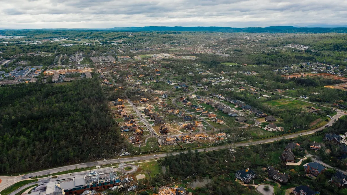
The natural disasters in Georgia that earn federal declarations are mostly not hurricanes, whatever the coast suggests. Of the state's 51 major disaster declarations since 1953, severe storms and tornadoes together outnumber hurricanes and floods combined, and March is the busiest month in the whole record, well ahead of any month in hurricane season. Georgia is a spring storm state that also gets hurricanes, and the hurricanes it gets tend to run the whole length of the state rather than stopping at the beach.
That second point is what you build for. The three declarations that covered the most counties in Georgia's history, leaving out the pandemic, were all tropical: Irma in 2017, Helene in 2024 and Michael in 2018. Helene's worst damage was in the Augusta area and the east Georgia pine country, and Michael tore through southwest Georgia farmland, neither of them anywhere near Savannah. So the kit is the power outage kit for the spring storms and the seven day hurricane kit from late summer on, and both are needed from Valdosta to Blue Ridge. The other states are in our natural disasters by state index.
A word on how FEMA counts, because the raw total of 82 Georgia declarations hides a lot. Fifty-one are major disaster declarations, the kind the President signs and the only kind that can pay households directly. Seventeen are emergency declarations, faster and smaller, and the biggest of those (Irma, Helene, Michael, the 2026 winter storm) were signed with the storm still on its way. Fourteen are fire management declarations, one per named wildfire, nearly all of them around the Okefenokee, and FEMA only started issuing those in volume in the late 1990s. Any one declaration can name a single county or all 159. The 1977 drought, the Katrina evacuation in 2005 and COVID in 2020 are statewide and not weather, so I've set them aside below.
Georgia disasters by type, 1953 to 2026
| Disaster type | Major declarations | When it usually hits | Example from the record |
|---|---|---|---|
| Severe storms (wind, hail, flooding, some tornadoes) | 17 | January through April | February 1998 storms and flooding, 119 counties |
| Tornadoes | 11 major, plus 2 emergencies | March, with a tail into spring | January 2017 tornadoes, 23 counties |
| Hurricanes | 10 major, plus 6 emergencies | September and October | Hurricane Irma, September 2017, all 159 counties |
| Tropical storms | 1 major, plus 3 emergencies | August through October | Tropical Storm Debby, August 2024, 35 counties |
| Flooding | 8 | March, and November | March 1966 floods, 23 counties |
| Ice and winter storms | 2 major, plus 3 emergencies | January and February | February 2014 ice storm, 91 counties on the emergency |
| Wildfire | 14 fire management | April and May | Sweat Farm Road fire, Ware and Charlton counties, April 2007 |
Two labels mislead. The January 2000 winter storm is filed as a severe storm, so the true winter count is one higher than the table shows. And the July 1994 declaration for Tropical Storm Alberto's flooding, which reached 55 counties, is filed under tornadoes.
Spring storms and tornadoes: the half of the record people underrate
Count the severe storm and tornado entries together and they make up more than a third of everything in Georgia's file. The month pattern is unmistakable. Tornado declarations cluster in March and taper through spring, severe storm declarations stack up from January through April, and by midsummer the file goes nearly quiet. The ones that reached farthest are in the table below. The January 2017 outbreak drew two major declarations in two days, both with household assistance, and the March 2008 tornadoes included the one that went through downtown Atlanta.
| Storm or outbreak | Counties on the declaration | Household assistance |
|---|---|---|
| February 1998 storms and flooding | 119 | No |
| April 2009 storms, flooding and tornadoes | 47 | Yes |
| February 1990 storms | 38 | No |
| April 2011 tornado outbreak | 26 | No |
| January 2017 tornadoes (two declarations) | 23 and 7 | Yes |
| April 1974 tornadoes | 20 | No |
| March 2008 tornadoes, including downtown Atlanta | 7 | No |
Tornado prep in Georgia is mostly warning and a place to go. A NOAA weather radio set to your county, with the alert on overnight from January through May, is the single most useful object on this page, because the alert tone is what gets a sleeping house into the hallway. Helmets for everyone in the safe room, and a lantern and headlamps for the days after, since these storms bring the lines down across whole counties.
Hurricanes: fewer than you think, bigger than you think
Georgia gets fewer hurricane declarations than Florida, Louisiana, North Carolina, Texas, Alabama or South Carolina, and every one of them began in August, September or October, with September and October carrying almost all of it. What it gets are storms that come in off the Gulf through Florida's Big Bend and run northeast across the entire state while still strong. Michael's damage was in the pecan and cotton country of the southwest. Helene's major declaration ran from the Florida line to the Carolina line and east to Augusta.
| Storm | Emergency declaration | Major declaration |
|---|---|---|
| Opal, October 1995 | 50 counties | |
| Frances, September 2004 | 80 counties | |
| Ivan, September 2004 | 31 counties | |
| Irma, September 2017 | 159 counties | 159 counties, household assistance |
| Michael, October 2018 | 108 counties | 69 counties |
| Idalia, September 2023 | 32 counties | |
| Debby, August 2024 | 55 counties | 35 counties |
| Helene, September 2024 | 159 counties | 94 counties, household assistance |
| Isaias, October 2026 | 76 counties |
Helene is why the hurricane kit belongs in every Georgia house. For most people on that declaration the problem was a week or more without power, not wind damage to the house. The things that mattered: a way to keep phones charged (a solar power bank needs no fuel), stored water for the wells that quit when the pumps lost power, a chainsaw and fuel, and cash, because card readers go down with the power. Keep the seven day kit stocked from August through October and don't assume the coast is the only place that needs it.
Okefenokee fire years
Eleven of Georgia's fire management declarations are in the Okefenokee counties, two more are on the coast (Blounts Pasture in McIntosh County and Harveytown in Bryan County), and they cluster in a few bad years. The 2007 season produced five of them, from Sweat Farm Road in Ware and Charlton to Bugaboo Scrub in Charlton. The 2011 season produced four more across Ware, Brantley, Charlton, Coffee and Long. West Mims burned across Charlton, Clinch and Ware in 2017, and April 2026 added Pineland Road in Clinch and Echols and the Highway 82 fire in Brantley. The one far from the swamp is the Tatum Gulf fire of November 2016 in Dade County, in the far northwest corner.
Nearly all of them started in April and May, when the swamp is low and the wind is up. Ware County appears in more Georgia declarations than any county in the state, and the fires are a big part of why. If you live between Waycross and the Florida line, a packed go bag in April, a few N95s for the smoke that hangs over the swamp for weeks, and a place for the animals to go are the kit; the bug out bag checklist has the rest.
Ice in Atlanta and the mountains
Georgia has six winter declarations for five storms once the January 2000 storm is counted, and the 2014 ice storm is the one that got two (an emergency declaration, then a major one). They fall in January and February, with the 1993 snowstorm the one March outlier, and the newest of them, in January 2026, was the widest.
| Winter storm | Counties on the declaration |
|---|---|
| March 1993 snowstorm (emergency) | 93 |
| January 2000 winter storm (filed as a severe storm) | 51 |
| February 2014 ice storm (emergency, then major) | 91, then 45 |
| February 2015 ice storm | 16 |
| January 2026 winter storm (emergency) | 112 |
Ice on the lines in the Piedmont and the Blue Ridge means days without power in houses heated by heat pumps that stop working, and roads that nobody in the state is equipped to clear.
The winter layer is cheap. Emergency blankets and a sleeping bag per person, a heater rated for indoor use with a carbon monoxide alarm beside it, and a winter car kit in every vehicle that commutes on I-285 or I-75 from December through February.
Which counties get hit the most
I counted how many separate declarations each county appears in since 1953. The list is unusual: the top is split between the Okefenokee counties in the far south and the mountain counties in the far north, with the Atlanta area and the coast in the middle.
| County | Declarations | What drives it |
|---|---|---|
| Ware (Waycross) | 24 | Okefenokee fires plus every hurricane that crossed south Georgia |
| Lumpkin (Dahlonega) | 24 | Mountain ice storms, floods and spring storms |
| Upson, Toombs, Tattnall, Pickens, Carroll, Brantley | 23 each | Spring storms and tornadoes across the middle, hurricanes and fires in the south |
| White, Pike, McIntosh, Fulton (Atlanta) | 22 each | Mountain ice, tornadoes, coastal storms, and metro Atlanta's share of everything |
No part of Georgia sits out the record. The north has ice and spring storms, the middle has tornadoes, the south has fire and hurricanes, and the three biggest storms covered all of it.
A Georgia disaster calendar
- January and February: 14 declarations, split between ice storms and the first tornado outbreaks. Weather radio on, blankets and safe heat ready, car kit in the trunk.
- March: the worst month in the file, with 16 declarations: tornadoes, severe storms, floods and the start of fire season. Safe room plan, radio alert on overnight.
- April and May: nearly as busy, with most of the wildfires and the big April tornado outbreaks. Go bag packed in the south, storm kit ready everywhere.
- June and July: seven declarations in the whole record. The quiet stretch. Build the hurricane kit.
- August: the first tropical systems, Debby and Idalia among them. Fuel, water, cash.
- September and October: 18 declarations, nearly all of them hurricanes or tropical storms: Opal, Frances, Ivan, Irma, Michael, Helene, Isaias. Full seven day kit, statewide.
- November and December: the odd late tornado and the Tatum Gulf fire. Restock.
Build order for a Georgia kit
- A weather radio before anything else. Georgia's record is tornado and storm heavy, and a warning is only useful if it wakes you. A NOAA radio with the county alert set is the first thing I'd buy.
- The seven day base. Water, shelf-stable food, headlamps, a lantern, phone power, cash, documents, pet supplies. The power outage kit checklist is the full list and it covers the ice storms, the spring storms and the hurricanes alike.
- The hurricane layer, statewide, August through October. More water, a chainsaw if you have trees, a cooling plan, and a vehicle that can leave if you're on the coast.
- The fire layer south of Waycross. Go bag by April, masks, animal plan.
- The winter layer north of Macon. Blankets, safe heat, CO alarm, car kit.
- Communications. Phones are only as good as the nearest tower and its generator. A pair of GMRS radios keeps a household talking and a Meshtastic node keeps a neighborhood passing text without a tower.
The same systems arrive from Florida and leave for South Carolina and Tennessee, and those pages show how differently the record reads across each state line. The storm prep guides cover the gear itself. The counts here are FEMA's declaration file as of October 31, 2026, Isaias included, and I'll correct the page as FEMA adds to it.
Questions people ask about Georgia disasters
What is the most common natural disaster in Georgia?
Severe storms and tornadoes. Together they account for 28 of Georgia's 51 major disaster declarations, well ahead of hurricanes and floods. By raw count wildfire is close behind with 14 fire management declarations, but those are counted one fire at a time and nearly all sit in the Okefenokee counties.
Does Georgia get hit by hurricanes?
Yes, and the big ones cross the whole state. FEMA's file has 16 hurricane declarations for Georgia, 10 of them major. Irma covered all 159 counties, and Helene and Michael each covered more than half the state on their major declarations. Every one of them began in August, September or October.
What month has the most disasters in Georgia?
March, with 16 declarations in the record, mostly tornadoes, severe storms and floods. September and October are next, and June, July and December are the quietest.
What was the biggest disaster in Georgia by FEMA's measure?
Hurricane Irma in September 2017 is the only weather event to put all 159 counties under a major disaster declaration. The February 1998 storms and flooding are next, then Helene's major declaration, which covered most of the eastern half of the state.
Does Atlanta get ice storms?
Yes. The February 2014 ice storm drew an emergency declaration for most of the state and then a major one, the January 2000 storm covered about a third of the counties, and the January 2026 winter storm put 112 counties under an emergency declaration. They come in January and February.
Where are the wildfires in Georgia?
Mostly the Okefenokee counties: Ware, Charlton, Brantley, Clinch, Echols and their neighbors account for 11 of the state's 14 fire management declarations, most of them in the bad years of 2007 and 2011. Two were on the coast in McIntosh and Bryan counties, and one, the Tatum Gulf fire, was in Dade County in the northwest corner. Fire season is April and May.
Sources
Ready to buy?
See current models and availability on Amazon. Your clicks keep these guides free.
Shop Emergency Kits on Amazon →