Natural Disasters in New York: 118 FEMA Declarations, and Why August Is the Month to Watch
The Catskills flood, Buffalo gets buried, Long Island takes the tropical hits, and the widest emergency in state history was a blackout. What the FEMA file says and what to keep on the shelf.
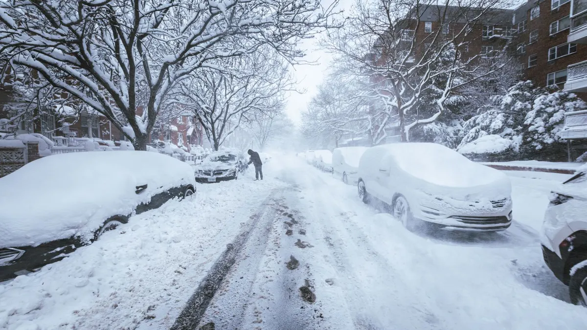
The widest emergency in New York's FEMA file is the August 2003 blackout, which drew an emergency declaration for 65 areas, more than Sandy, more than the 1993 blizzard, more than any weather event in 70 years of records. That's the right place to start a page on natural disasters in New York, because the pattern in the data is less about any one hazard and more about losing power and losing roads. The state has 118 federal declarations since 1954, and the major disasters split almost evenly between severe storms, floods, tropical systems and snow, with more major snowstorm declarations than any other state we have pulled. August alone accounts for nearly one declaration in five, because that's when tropical remnants come up the Hudson and stall over the Catskills.
So the New York kit is the week-without-power kit first, built to work in both July heat and a January cold snap, and then a regional layer on top: flood awareness in the Catskills and the Southern Tier, coastal surge planning on Long Island and in the five boroughs, and a serious winter setup from Buffalo to Watertown, where a lake effect band can bury a town in a couple of days. This page is part of our natural disasters by state series. The base list of gear is in the power outage kit checklist.
A note on the three kinds of entries in FEMA's file. A major disaster declaration unlocks federal repair money for counties and, when Individual Assistance is added, payments to households. An emergency declaration is smaller and faster, and often comes while the storm is still happening; New York's include the 2003 blackout, the 1993 blizzard and the declaration for Sandy signed while the storm was still over the state. A fire management declaration reimburses the state for fighting one wildfire, and New York has only three in its history, the latest for the Jennings Creek fire in Orange County in November 2024. Two statewide entries aren't weather and are in every state's file, the 2005 Katrina evacuation and COVID in 2020; the September 11 attacks are a third, and they're set aside below. The file counts events, not people: Hurricane Bob in 1991 is one declaration for one county. I pulled the county list for every event to sort the big ones from the small ones.
New York disasters by type since 1954
| Disaster type | Major declarations | When it usually hits | Example from the record |
|---|---|---|---|
| Severe storms (wind, rain, mixed) | 28 | May through September | May 2004 storms and flooding, 62 areas |
| Flooding | 26 | March, and again July | January 1996 snowmelt flood, 41 areas |
| Hurricanes and tropical storms | 13 major, plus 6 emergencies | August and September | Hurricane Irene, August 2011, 32 areas |
| Snowstorms and winter storms | 10 major, plus 13 emergencies | December through March, with an October surprise | March 2017 snowstorm, 28 areas |
| Ice storms | 2 | March and April | April 2003 ice storm, 16 areas |
| Everything else | 6 | No pattern | 2002 earthquake, 6 areas; 1965 water shortage, 14 areas |
Major declarations only in the second column. The 2001 fires and explosions declaration, the 1993 World Trade Center explosion, the 2020 pandemic and a 2010 tornado declaration make up the rest of the 85.
A New York disaster calendar
The calendar tells the story faster than the hazard list does, so it comes first.
- January: mostly snow, plus the 1996 snowmelt flood. Winter kit in the car, heat plan at home.
- February: snow, and the start of ice jam season on the rivers.
- March: the surprise month, with as many snowstorms (1993, 2017) as floods. Keep the winter kit in the car and watch the creeks.
- April through June: ice storms in April, then the spring severe storm season.
- July: summer flash flooding, especially in the Catskills.
- August: the worst month in the file by a wide margin, with 23 declarations. Tropical remnants, the 2003 blackout, Irene. Water stored, phone power sorted, weather radio on.
- September: still tropical season: Floyd, Lee, Ida.
- October: Sandy, the 2006 lake effect storm, late tropical remnants.
- November and December: lake effect season opens: 2014, 2022.
Tropical remnants and the Catskill problem
New York doesn't get many landfalling hurricanes. What it gets is the leftovers. The tropical declarations that did the widest damage were storms that had already been downgraded by the time they reached the state, and nearly all of them began in August or September. Sandy in October 2012 was the exception, a coastal storm that hit Long Island and the city directly.
| Storm | Areas on the declaration | Note |
|---|---|---|
| Tropical Storm Agnes, June 1972 | 26 | Filed as a flood; the one tropical entry before August |
| Floyd, September 1999 | 15 | |
| Irene, August 2011 | 32 | Individual assistance |
| Remnants of Lee, September 2011 | 15 | Two weeks after Irene, also with household aid |
| Sandy, October 2012 | 62 on the emergency, 14 on the major | Coastal, Long Island and the city |
| Remnants of Ida, September 2021 | 14 | |
| Remnants of Fred, August 2021, and Debby, August 2024 | 9 and 11 |
Look at where the water goes. The top of the county list isn't the coast. It's Delaware County, Ulster, Orange, Sullivan, Chenango, Broome and Schoharie: the Catskills and the Southern Tier, where tropical rain piles up against the mountains and runs down the Esopus, the Delaware and the Susquehanna. Suffolk, Westchester, Nassau and Rockland are close behind, but their declarations lean toward coastal flooding and wind.
For the kit, that means two different plans. In the Catskills and the Southern Tier, the hazard is a creek that comes up overnight: a NOAA weather radio with the alert tone on, documents in a dry bag, and a rule about which road you take out and when. On Long Island and the coast, it's surge and a long outage: the full seven-day hurricane kit (a Carolina list, but Long Island needs every item on it), stored water and a way to charge phones, which is where a solar power bank earns its place.
Snow: Buffalo, Watertown and the lake effect calendar
New York has 21 declarations filed as snowstorms, plus two more winter storm emergencies that the table counts with them, and no state in this series comes close on the major count. The calendar is wider than you'd guess: January and March tie for the most, December is next, and there are entries as early as October, including the October 2006 lake effect snowstorm, the earliest in the file.
| Snowstorm | Areas on the declaration | Note |
|---|---|---|
| Blizzard of 1977 | 9 | |
| March 1993 blizzard | 62 (emergency) | The widest weather event in the file |
| Blizzard of 96, January 1996 | 19 | Followed by the snowmelt flood |
| November 2014 | 9 | |
| March 2017 | 28 | The widest snow major disaster |
| Winter of 2022 to 2023 | 11 (November emergency), then 5 (Christmas week major) | Individual assistance on the second |
What the snow declarations have in common is people stuck: in cars, in houses without heat, in towns with the roads closed for days. The winter car emergency kit isn't optional west of Syracuse. At home it's a safe indoor heat source with a carbon monoxide alarm, sleeping bags rated well below freezing, emergency blankets for the car, and a lantern and headlamps, because ice on the lines takes the power out with the snow.
Floods that have nothing to do with hurricanes
Twenty-six major flood declarations, and the month pattern shows a second season most people forget: March ties July for the most flood declarations, driven by snowmelt and ice jams. The January 1996 flood that followed the Blizzard of 96 is the clearest case, rain on top of what the blizzard had left, and it covered 41 areas. The 1985 snowmelt and ice jam declaration, the April 2011 flood, the June 2013 flood and the 2017 Lake Ontario high water declaration round out the list. The Southern Tier, the Mohawk Valley and the Lake Ontario shore are the places that show up over and over.
The gear overlaps with the tropical list, with one addition: if you live along a river that ice-jams, pay attention in late February and March as well as August.
The other entries, and the blackout
New York's file has more non-weather declarations than most states: the Love Canal chemical waste emergencies in 1978 and 1980, the 1993 World Trade Center explosion, the September 2001 declaration for the whole state, the West Nile virus emergency in 2000, and the April 2002 earthquake in the Adirondacks that drew a major declaration for a handful of counties. And the blackout. On August 14, 2003 the grid went down across the Northeast, and FEMA issued an emergency declaration for 65 areas in New York, the widest in the state's history. It took out water pumps and gas stations in some places, and it's the single best argument for the week-without-power base kit in a state that otherwise thinks of itself as safe.
Counties at the top of the file
| County | Declarations | Mostly |
|---|---|---|
| Delaware | 39 | Catskill flooding, tropical remnants |
| Ulster | 37 | Flooding, Irene, Sandy |
| Suffolk (eastern Long Island) | 36 | Coastal storms, hurricanes, snow |
| Orange | 36 | Flooding, tropical remnants, two of the state's three wildfires |
| Sullivan | 35 | Flooding |
| Westchester | 32 | Coastal and river flooding, Sandy, Ida |
| Nassau, Chenango | 31 each | Coast on one, Southern Tier floods on the other |
| Rockland, Broome | 30 each | Hudson Valley flooding; Susquehanna flooding |
| Schoharie, Rensselaer | 29 each | Flooding, Irene |
Erie County and the Buffalo area don't top this list because snow declarations tend to cover a handful of counties each, but the snow entries are concentrated there.
Matching gear to the hazards
- The week-without-power base, for any address in the state. Water at one gallon per person per day for seven days, food that needs no cooking, a weather radio, headlamps, phone power, cash, copies of documents. The power outage kit checklist has the full list. The 2003 blackout and Sandy both ran on this kit.
- The winter layer, mandatory from Buffalo to the North Country and sensible everywhere. The winter car kit, indoor heat with a carbon monoxide alarm, cold-rated sleeping bags, and enough fuel to run whatever heats the house for three days.
- The flood layer in the Catskills, the Southern Tier and the Mohawk Valley. Weather radio alerts on at night, documents waterproofed, a get home bag in the vehicle, and a written rule for when you leave.
- The coastal layer on Long Island and in the city. Everything in the base kit, portable, plus your evacuation zone looked up before hurricane season and a plan for where you go.
- Communications. When the power goes wide, the phones follow. A pair of GMRS radios keeps a block talking, and a Meshtastic node carries text across a neighborhood with no tower at all.
Questions people ask about New York disasters
What is the most common natural disaster in New York?
Severe storms and flooding, which together make up 54 of the 85 major disaster declarations since 1954. Count all declarations, major and emergency, and snow has 21 entries, more than any other state in our series.
Does New York get hurricanes?
Rarely as hurricanes, often as remnants. The file has 19 tropical declarations, and most of the big ones (Agnes, Floyd, Irene, Lee, Ida) arrived as heavy rain over the Catskills and the Southern Tier rather than as wind on the coast. Sandy in 2012 was the exception.
What was the biggest disaster in New York by FEMA's count?
By areas covered, the August 2003 power outage emergency declaration at 65. Among weather events, the March 1993 blizzard emergency, the May 2004 storms and flooding, and Sandy's emergency declaration each covered 62 areas. Irene's major declaration covered 32 counties and came with Individual Assistance.
When is the worst month for disasters in New York?
August, with 23 of the 118 declarations, mostly tropical remnants and summer flooding. September is second, and March is third because it gets both late snowstorms and snowmelt floods.
Which part of New York is safest?
No county is absent from the file. The Catskills and the Southern Tier have the most declarations, the coast and the Hudson Valley are next, and western New York carries most of the snow entries. The Finger Lakes and the central counties show up less often, but they're still in the statewide August 2004 declaration and the January 1996 flood.
Does a declaration mean I can get FEMA money?
It depends on whether Individual Assistance was added for your county, which happened for Irene, Lee, Sandy, Ida, the 2022 Christmas storm and a handful of others in this file. Most declarations only repay counties and towns. FEMA's declaration page lists it by county. Photograph the house in the spring either way.
The upshot for your kit
A week without power is the base plan anywhere in New York; add the winter kit if you live anywhere a lake effect band can reach, and treat August and September as flood season if you live in the Catskills or the Southern Tier. Long Island and the city plan for surge. The numbers behind this page are FEMA's public declaration file through November 2024, copied at the end of October 2026; the counts will move as new declarations are signed. See how the pattern changes across Lake Erie in Ohio, or farther west in Michigan, or go to the storm prep guides.
Sources
Ready to buy?
See current models and availability on Amazon. Your clicks keep these guides free.
Shop Emergency Kits on Amazon →