Natural Disasters in Minnesota: Spring Floods on the Red River, Summer Wind Everywhere Else
Eighty-one federal declarations since 1957, and the top twelve counties are all in the Red River and Minnesota River valleys. March and June tie as the worst months. Here is the pattern and the kit that fits it.
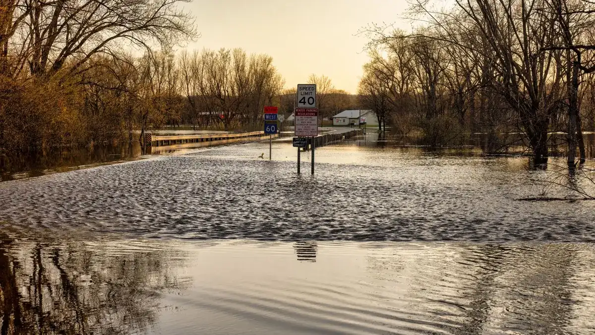
Every one of the twelve Minnesota counties with the most federal disaster declarations sits in the Red River basin or the Minnesota River valley. Norman County leads the state, then Polk, Marshall, Kittson and Clay, a line of flat farm counties along the North Dakota border that flood when the snow melts faster than the river can drain north. That's the first thing the FEMA file says about natural disasters in Minnesota: 81 declarations between 1957 and October 2025, most of them major disasters, and flooding is the biggest single category by a wide margin. Only Texas, California and Washington have more flood declarations among the 22 states we have pulled. Severe storms are second, nearly all of them summer wind and rain, and March and June tie as the worst months.
The kit, then, has two seasons. In March and April, anyone in the Red River Valley, the Minnesota River valley or along the upper Mississippi needs a flood plan, a sump backup and water on the shelf before the wells go under. From May through August the whole state needs the week-without-power kit, because the storm declarations are about trees on lines across dozens of counties at a time. And underneath both sits a winter that has produced a 55-county disaster declaration more than once. The rest of the country is in our natural disasters by state index. The base gear is in the power outage kit checklist.
Two notes on the counting. FEMA's file has three tiers: major disaster declarations (the presidential ones that pay counties for repairs and sometimes pay households), emergency declarations (faster and smaller; Minnesota's include the 1976 drought and the 2007 bridge collapse) and fire management declarations (one wildfire each; seven of Minnesota's ten came in a single autumn, 1976). The two statewide entries that aren't weather, the 2005 Katrina evacuation and COVID in 2020, are in every state's file and are set aside below.
Minnesota disasters by type, 1957 to 2025
| Disaster type | Major declarations | When it usually hits | Example from the record |
|---|---|---|---|
| Flooding | 30 | March and April, then June and August | Spring 2001 flood, 72 counties |
| Severe storms (wind, hail, rain) | 25 | May through July | May 1993 storms, tornadoes and flooding, 57 counties |
| Tornadoes | 3 | March through June | May 1998 storms and tornadoes, 19 counties |
| Ice storms, snow and winter storms | 3 named, plus 4 filed as severe storms | October through April | January 1997 winter storms, 55 counties |
| Straight-line winds | 1 | June 2025 | One county, with household assistance |
| Everything else | 1 | No pattern | 2020 pandemic |
Minnesota files a lot of its winter under the severe storm heading. The ice storm that began on Halloween 1991, the November 1996 ice storm, the January 1997 winter storms, the November 2005 winter storm and the April 2013 winter storm are all in the file; three carry a winter label and the rest are typed as severe storms. They're counted together above.
A Minnesota disaster calendar
The year has two peaks and two dead months, and the calendar is the quickest way to see it.
- January: five declarations, including the 1997 winter storms. Winter kit in the car, heat plan at home.
- February: none in 68 years. The quiet month.
- March: tied for the worst month, and most of its entries are snowmelt floods on the Red and the Minnesota. Sump backup tested, water stored, weather radio on for crest forecasts.
- April: the flood season continues (1965, 1969, 1978, 1979, 2022, 2023), plus the April 2013 winter storm.
- May: the handoff from flood to storm season, including 1993 and the May 2025 fire.
- June: tied with March for the worst month. Storms with wind, hail and tornadoes across wide areas: 2014, 2018, 2024, and the 1976 drought.
- July: more summer storms and flooding.
- August: late summer flooding and storms, and the 2007 bridge collapse.
- September: mostly the 1976 fires and the fall storms of 2004, 2010 and 2016.
- October and November: the 1991 and 1996 ice storms, the 2000 fire, the 2005 winter storm.
- December: none. Restock and check the car kit.
The Red River and the spring flood season
Minnesota's flood declarations begin in March more often than any other month, with April second. That's snowmelt, and on the Red River it's made worse by geography, since the river runs north into ice that hasn't broken up yet. The widest weather declarations in the state's file are all spring floods.
| Flood | Counties on the major declaration | Note |
|---|---|---|
| Spring 2001 | 72 | Snowmelt and storms that began in late March; the widest weather declaration in the file |
| Spring 1969 | 70 | |
| Spring 1965 | 65 | |
| April 1997 | 59 | The Red River year |
| March 2019 | 55 | Winter storm and flood together |
| Spring 2011 | 34 | |
| Spring 2010 | 28 | After a 29-area emergency declaration in March |
| Spring 2023 | 26 |
The county list makes the geography plain. The top nine counties in the state, with Yellow Medicine and Blue Earth right behind, are all in the Red River basin or the Minnesota River valley. Blue Earth and Renville show that the Minnesota River floods the same way, just later and lower.
Spring river flooding gives you days of warning, which changes the kit. It's less about getting out at 3 a.m. and more about a long wet week: a NOAA weather radio for the crest forecasts, a battery or generator backup for the sump pump, the furnace and water heater raised if the basement has ever taken water, documents and the insurance file in a dry bag, and stored water for every household on a well, because a flooded wellhead means a boil notice that can run for weeks. The long-term water storage guide covers how to keep enough on hand without rotating it every month.
Summer: wind, hail and the second flood
From May through August, Minnesota's declarations shift to storms, and the flood count picks up again in June and August as summer rain lands on saturated ground. The events with reach: May 1993 (storms, tornadoes and flooding across 57 counties), June 2014 (storms, straight-line winds, flooding and mudslides across 40), June 2018, June 2024 with individual assistance, and three separate declarations for the spring and summer of 2022. The July storms of 1975 and 1978 and the 1995 storm that listed heat in its title round out the picture.
Tornadoes are in there, but FEMA rarely files Minnesota events under the tornado heading: just three, for the March 1998 outbreak, the May 1998 storms and the June 2010 storms. Most tornado damage ends up inside a combined storm declaration.
What a Minnesota summer storm does is take out power for days across a wide area, usually in heat. The gear is the week-without-power base plus a cooling plan: a lantern and headlamps, a solar power bank for phones and a fan, a cooler plan for the freezer, and a chainsaw if you have mature trees over the house or the driveway. The weather radio with the alert tone on covers the tornado warnings.
Winter: 55 counties at a time
Minnesota has only one declaration filed as a snowstorm and two as ice storms, which understates it. The January 1997 winter storms drew a major disaster for 55 counties, the March 2019 storm and flood another 55, and the storm that began on Halloween 1991 was declared as an ice storm that December. Winter here is the baseline, not the disaster, which is why the declarations only come when a storm closes the roads and the grid together across half the state.
The winter car emergency kit is the first purchase for anyone who drives between towns from November to April. At home: indoor-rated heat with a carbon monoxide alarm beside it, sleeping bags rated well below zero, emergency blankets in each vehicle, and a plan for the pipes if the furnace stops. The 2019 declaration is the reminder that a late winter storm can run straight into the spring flood.
Drought, fire and the bridge
The 1976 drought is the fourth-widest entry in Minnesota's file, an emergency declaration for 78 areas in June, and it was followed that fall by seven fire management declarations in under four weeks for seven separate fires. The state's other wildfire entries are the Carlos Edge fire complex in October 2000, the By-Pass fire in Crow Wing County in 2002, and the Munger Shaw fire in St. Louis County in May 2025. The fire calendar is September, with a smaller May peak. Anyone in the Arrowhead or the pine country north of Brainerd should have a go bag packed in a dry spring and a dry fall. And one entry isn't weather at all: the August 2007 emergency declaration for a bridge collapse in a single county.
Which counties get hit the most
| County | Declarations | Where it is |
|---|---|---|
| Norman | 32 | Red River Valley |
| Polk | 31 | Red River Valley |
| Marshall, Kittson | 30 each | Red River Valley, far northwest |
| Clay (Moorhead) | 29 | Red River Valley |
| Roseau | 26 | Northwest, Roseau River |
| Wilkin, Traverse | 25 each | Head of the Red River, Bois de Sioux |
| Yellow Medicine, Blue Earth | 24 each | Minnesota River valley |
| Red Lake | 23 | Northwest |
| Renville | 22 | Minnesota River valley |
All 87 Minnesota counties appear somewhere in the file. Hennepin and Ramsey aren't near the top, probably because the metro's declarations are mostly wide summer storms while the river counties upstream take the flood hits year after year.
Gear for the hazards above
- The week-without-power base, for every address. A gallon of water per person per day for seven days, no-cook food, a weather radio, headlamps, phone power, cash, copies of documents. The power outage kit checklist has the list, and it's what gets you through a June storm outage.
- The winter layer, statewide. The winter car kit in every vehicle, indoor heat with a carbon monoxide alarm, below-zero sleeping bags and a pipe plan.
- The flood layer in the Red River Valley, the Minnesota River valley and the Mississippi river towns. Sump backup, dry bag for documents, stored water if you're on a well, and the furnace and water heater up off the basement floor.
- The fire layer in the north woods. A packed go bag in dry springs and dry falls, with N95 masks for smoke.
- Communications. Wide storm outages take the cell towers with them. GMRS radios for the farm or the block and a Meshtastic node for text across town work with the towers dark.
Questions people ask about Minnesota disasters
What is the most common natural disaster in Minnesota?
Flooding, with 30 of the 63 major disaster declarations since 1957, most of them spring snowmelt floods on the Red River and the Minnesota River. Severe storms are second, nearly all between May and August.
Which part of Minnesota has the most disasters?
The Red River Valley. Norman, Polk, Marshall, Kittson and Clay counties have the most declarations in the state, followed by Roseau, Wilkin and Traverse. The Minnesota River counties (Yellow Medicine, Blue Earth, Renville) are next. Every county in the state has been named at least once.
What was the biggest disaster in Minnesota history by FEMA's count?
For weather, the spring 2001 flood, a major disaster declaration for 72 counties. The 1969 and 1965 floods are next, then the 1997 Red River flood and the 1993 storms. The January 1997 winter storms and the March 2019 storm and flood each covered 55 counties.
Does Minnesota get tornadoes?
Yes, but FEMA has filed only three Minnesota declarations under the tornado heading, two in 1998 and one in 2010. Tornado damage usually ends up inside a combined storm declaration, like May 1993, June 2010 or the summer of 2022. The months are May, June and July.
When is the worst time of year for disasters in Minnesota?
Two peaks: March, for snowmelt flooding, and June, for severe storms, with 14 declarations each. September is next, mostly because of the 1976 fires. February and December have none at all.
Does a FEMA declaration mean I get money?
Only if Individual Assistance was turned on for your county. In Minnesota's file that happened for the 2004, 2007, 2009, 2016, 2024 and 2025 events, plus the pandemic. Most declarations repay counties and cities for roads, levees and debris. Check your county on FEMA's declaration page, and get pictures of the house, the basement and the yard before the melt, while the ground is still frozen.
If you read nothing else
If you live in the Red River Valley or along the Minnesota River, March and April are your season and the sump pump and the well are the weak points. Everyone else builds for a week without power in June or July and keeps the winter kit in the car the other half of the year. The numbers behind this page are FEMA's declaration file through October 2025, as pulled on October 31, 2026; the next Minnesota declaration will be added when it posts. See how a Great Lakes neighbor compares in Michigan, or go to the storm prep guides.
Sources
Ready to buy?
See current models and availability on Amazon. Your clicks keep these guides free.
Shop Emergency Kits on Amazon →